
Swainsboro and Emanuel County, Georgia
Visitors to Swainsboro and Emanuel County will find themselves in a gently rolling landscape of fields, woods and sandy soil. Under a canopy of piney woods, the forest floor is still carpeted with wiregrass, flora and fauna. The native deer, rabbits, raccoons, opossums, alligators, fish, bobcats, quail, foxes, snakes, turtles, and other wildlife compete with recent immigrants such as coyotes and armadillos.
The Ohoopee, Ogeechee, and Canoochee rivers flow through the county, and the smaller streams and innumerable ponds make the region an excellent recreation and fishing area. Along the waterways and low-lying areas are stands of hardwoods. The original inhabitants were, of course, Native Americans. In historical times, Creek Indians lived in the area and, although little material evidence remains to document them here, the names of rivers, historical accounts, and archaeological artifacts testify to their presence. The Indian cessions of 1773 and 1783 conveyed the land that now comprises Emanuel County to the state of Georgia.
The county was established by legislative action in 1812, and was named for David Emanuel, who served briefly as the state’s chief executive in 1801. Swainsboro has been its seat since 1814, except for a brief period in the 1850’s when its name was changed to Paris. In addition to Swainsboro, several smaller towns and communities developed over the years and continue to dot the landscape, including Adrian, Twin City (once the separate towns of Graymont and Summit), Stillmore, Summertown, Oak Park, Nunez, Covena, Lexsy, Modoc, Canoochee, Coleman Lake, and Blundale, to name a few. The pioneer settlers of Emanuel County began to move into the area in the late 1700s in the aftermath of the Indian cessions.
Noting the characteristically massive, open pine forests of the region, they called their new home the “pine barrens” or “wiregrass Georgia.” Early migrants acquired property by land lottery and the headright system and also by means of land granted for military service in the Revolutionary War. Several veterans of that conflict lie buried in the county. The fact that many of the names left by the pioneers--Thigpen, Sumner, Lane, Durden, Brinson, Overstreet, Thompson, Moore, Rountree, Edenfield, Tapley, Key, Coleman, among many others-- survive among today’s inhabitants lends a strong sense of familial continuity to the region. These settlers engaged in subsistence farming. They raised a few crops and livestock, hunted and fished, and set about the task of carving out of the forests the communities that were to characterize the county.
Progress was slow and as late as the Civil War, Emanuel County was lightly populated. Wild lands predominated over cultivated areas. But, as the nineteenth century progressed, Emanuel Countians underwent significant transformations as they found themselves caught up in larger political and economic events.
As the Civil War erupted, a good number of the county’s young men volunteered to serve the Confederate cause and left home, some never to return. Seemingly far removed from the major conflict, local folks found themselves inundated by Federal troops in late November and early December of 1864 as General Sherman’s Union forces marched through on their way to Savannah. For those who witnessed it, the March to the Sea was traumatic, and the war lives on in the stories passed down by local families and in the cemeteries containing the graves of soldiers who fought in the conflict.
Since the times of the earliest settlers, rich and fertile soil, temperate weather, and free-flowing streams and rivers have contributed to a productive society. The economy of Emanuel County was established on agricultural productivity and timberland. In time, the towering pine forests led to the development of industry and commerce. In the cultivated fields, common crops include cotton, corn, tobacco, soybeans, peanuts, and wheat. Hogs, goats, and cattle represent the major varieties of livestock.
The lumber and pulpwood industry continues to be important. However, Emanuel County has a mixed and diverse economy. In addition to agriculture, banking, metalworking, manufacturing, and public sector employment make for a more balanced economy. Manufacturing has progressed through textile industries, woodworking and cabinet building, chemical production, metalworking and fabrication to the latest in computer-controlled manufacturing capabilities. Pine trees and cotton are still valuable assets to the local economy, but the greatest asset is the industrious heritage of those individuals working in the region.
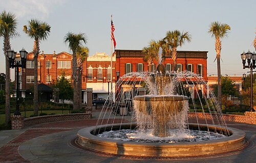
For more information about the community, visit the City of Swainsboro.
History of Emanuel County
From Emanuel Memories, 1776-1976.
Some 250 years ago the Lower Creek Indians lived in the territory of Georgia now known as Emanuel County. They hunted deer and other wild game for food and pelts; held their War and Green Corn dances; fished the Ohoopee and the Cannoochee rivers; roamed the forest; loved, hated, and passed on, leaving evidence of their arrowheads and other relics still found today.
Located in the Northeast portion of Emanuel County, the oldest man-made structure in Emanuel County is believed to be the long, low dam at McKinney's Pond. There is no record of the erection of McKinney's Pond Dam. Tradition has it that the stream was dammed by beavers first and that the Indians hauled dirt to the site to strengthen and improve the structure. Later, white men did the same.
When all this occurred no one knows, but specialists with the State of Georgia have estimated the ages of the trees now growing on the dam to be over 300 years old.
Eventually, white men arrived in the area seeking furs, gold, adventure, or a place to settle. Drawn by the prospect of land of their own and beneficial fur trade, early settlers from Savannah and the Carolinas began to move westward and southward primarily along water routes.
By 1741, it was deemed in the interest of good government to divide the Georgia Colony at Savannah into two counties: Frederica and Savannah. The latter included all settlements on the Savannah River and both banks of the Great Ogeechee River. These two counties were subdivided into districts, and these districts were later divided into parishes for establishment of religious worship according to the rites and ceremonies of the Church of England.
In 1777 the parishes were replaced by counties, this being ratified by the first State Constitutional Convention in Savannah. The section of Georgia now known as Emanuel County became a part of Washington County. From Washington County, at a later date, was formed Montgomery County with its county seat at one time located within five miles of Swainsboro.
Official creation of Emanuel County was in 1812 when the Georgia Legislature authorized it to be cut from territory that was part of Bulloch and Montgomery counties. The idea for forming the county is attributed to Stephen Swain, who had been elected in 1812 to represent Montgomery County in the Georgia Senate.
Swain was the youngest son of Stephen Swain Sr., a veteran of the Revolutionary War who had moved to Georgia in 1790. The elder Swain received a grant of 200 acres of land on the Ohoopee River in old Washington County.
In November 1812, Swain introduced a bill to create the new county. The bill passed with no opposition.
Emanuel County was named for one of Georgia's most obscure and least known Governors, David Emanuel. The son of John Emanuel, the family came to Georgia from Lunenburg County, Virginia around 1756.
The City of Swainsboro is the county seat and is named for Stephen Swain.